The post Covid aviation industry
The aviation industry has suffered one of the toughest setbacks in its history with the COVID-19 pandemic. The reduction in human mobility significantly affected global air traffic. In 2021, when mobility began to be reactivated, green shoots began to appear, with the number of flights on the rise, reaching figures close to those prior to the pandemic.
In the civil sector, the global drone market is expected to reach $41.3 billion by 2026, at a CAGR of 9.4%. In this segment, the most demanded functionalities are Urban Aerial Mobility (UAM), which Deloitte in one of its reports estimates to be worth US$115B in 2035, and package delivery by drones, with a market growth rate of 48% in 2029.
The situation experienced during the COVID pandemic has demonstrated the critical role that unmanned aviation can play in the development of a more efficient and safer world. The Spanish Aerospace Technology Program is seen as an excellent opportunity to grow the sector in the coming years, creating a more sustainable and green industry.
“Drones are a clear part of the future transportation and logistics landscape.”
Adina Vălean
European Commissioner for Transport
Enabling drones in logistics
In line with the evolution of the aerospace industry, developers of unmanned aerial systems (UAS) have been improving their flight control solutions to enable their customers to offer package delivery services and achieve efficient use of drones in logistics. In this regard, important functionalities have been adjusted to make this capability more accessible, secure and easy to use.
Automatic actions at waypoints
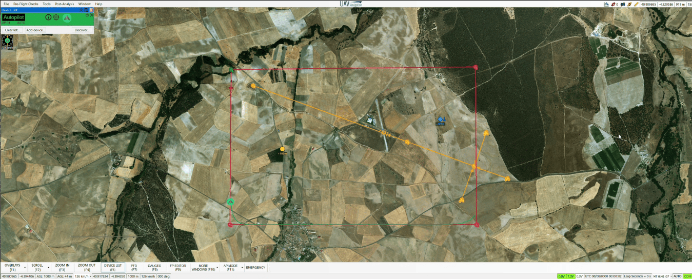
One of these features is automatic actions at waypoints, allowing the platform to perform a complete delivery service without operator intervention. The package can be delivered automatically through the use of an unmanned aerial vehicle, while the staff prepares another order for delivery later, reducing costs and time for the customer. This methodology would optimize and even solve the famous Last Mile Delivery problem.
These services require an advanced and reliable system with a logic that increases flight safety. Guidance, navigation and control solutions, such as the one implemented by UAV Navigation, also include configurable conditional actions based on alarms that may occur during flight. The autopilot can change its course to an emergency or alternate airfield and complete the mission in the event of fuel shortage, loss of communications or other circumstances, ensuring the integrity of the aircraft and the package.

Innovative solutions
The advanced algorithms included in the AHRS (attitude and heading reference systems) help to have extraordinary control during landing without any external infrastructure, which facilitates commercial launch and reduces the associated costs of the cargo delivery service. These are three-dimensional sensors that provide information on the heading, attitude and yaw (rotational movement) of an aircraft. In some cases, ADS (Air Data System) systems are used to estimate wind direction for safe package delivery.
This technique is also used in flight control solutions for VTOL (vertical take-off and landing) platforms, where the aircraft’s heading can be critical in its vertical take-off and landing stages of flight. These types of platforms are also beneficial in delivery missions, as they can cover long distances in a short period of time and perform a stationary flight maneuver to execute the cargo launch.
These systems can also control hybrid fixed-wing VTOL platforms, creating flight plans for fully automatic and autonomous operation of these possible aircraft configurations.
Multi-UAV operations
In addition to all these capabilities, multi-UAV or multi-operator operations missions in which several UAVs fly in the same airspace are also missions of great interest in drone cargo services, as they allow having a greater number of systems in the air working in the same airspace in a coordinated manner. Therefore, a flexible approach is essential to meet technical challenges.
VaNeT Project
Finally, in addition to the capabilities and features already existing and previously mentioned, in view of the requirements of this industry, it is worth mentioning the VaNeT project, presented by UAV Navigation together with CATEC (Centro Avanzado de Tecnologías Aeroespaciales) within the CERVERA call for proposals.
This project aims to develop and promote a multi-agent network node for the safe transport of goods by UAVs in shared airspace. It is financed by the Center for Technological and Industrial Development (CDTI) and the Spanish Ministry of Science and Innovation and co-financed by the European Regional Development Fund (ERDF).
Thus, the private sector in collaboration with the public sector continues to work day by day with the objective of leading the way for future drone applications and helping the industry to evolve and grow. To this end, new tools continue to be developed to allow more complex and demanding operations to be executed safely and efficiently, which helps to improve the operator’s situational awareness.
Miguel Ángel de Frutos, technical director of UAV Navigation, Grupo Oesía
